
FAQs
- Set policy directions and inform the challenges facing the City
- Provide an integrated approach for informed decision-making and solutions
- Assist in responding to the State planning agenda and for planning code amendments
- Advocate to the State Government for supporting policies and engagement on projects
- Foster collaboration with neighbouring Councils for planning and infrastructure projects
- Use for applications for grant funding.
- Protection areas were identified based on the Council's response to consultation undertaken as part of the implementation of the new Planning and Design Code, in particular, the transition of existing planning policy from Council’s former Development Plan to the new Code.
- Urban Form Diversity areas identified for additional growth were based on existing planning policy, the proximity of land to essential services and the 30 Year Plan for Greater Adelaide, which identified key growth corridors throughout the city. To this end, new housing development is proposed to be more concentrated in retail/commercial centres, along major road corridors, and in redevelopment precincts.
- every 15 minutes between 7.30 am and 6.30 pm, Monday–Friday
- every 30 minutes between 6.30 pm and 10 pm, Monday–Friday
- every 30 minutes on Saturday, Sunday and South Australian public holidays
- The Road network comprises a hierarchy of roads and streets:
- Arterial road (State maintained road) (such as Portrush Road, Greenhill Road, Glen Osmond Road, Magill Road, Kensington Road)
- Sub-arterial road
- Primary Collector road
- Secondary Collector road
- District Road
- Local Road (street)
- A 40 km/h speed limit area is a measure to support and reinforce the traffic calming treatments. It can be applied to an entire suburb or a precinct within a suburb.
- Traffic calming treatments in local streets includes the following measures:
- Slow points with narrowed sections of roadway
- Chicanes where the traffic must slow down to weave around kerbside build-outs
- Flat top road humps along mid-block sections
- Pavement treatments with different colours and textures, in particular at intersections or high pedestrian crossing areas
- Mini-roundabouts at intersections
- A sharrow is a bicycle pavement marking along a local street indicating shared use of the traffic lane with bicycles and vehicles and providing route guidance for cyclists
- A bicycle lane is a painted lane along the edge of a collector or arterial road.
- A separated bicycle lane is along the edge of a road and has a physical feature separating bicycles and vehicles.
- A shared path is available for pedestrians and bicycles and is typically provided through parks and reserves.
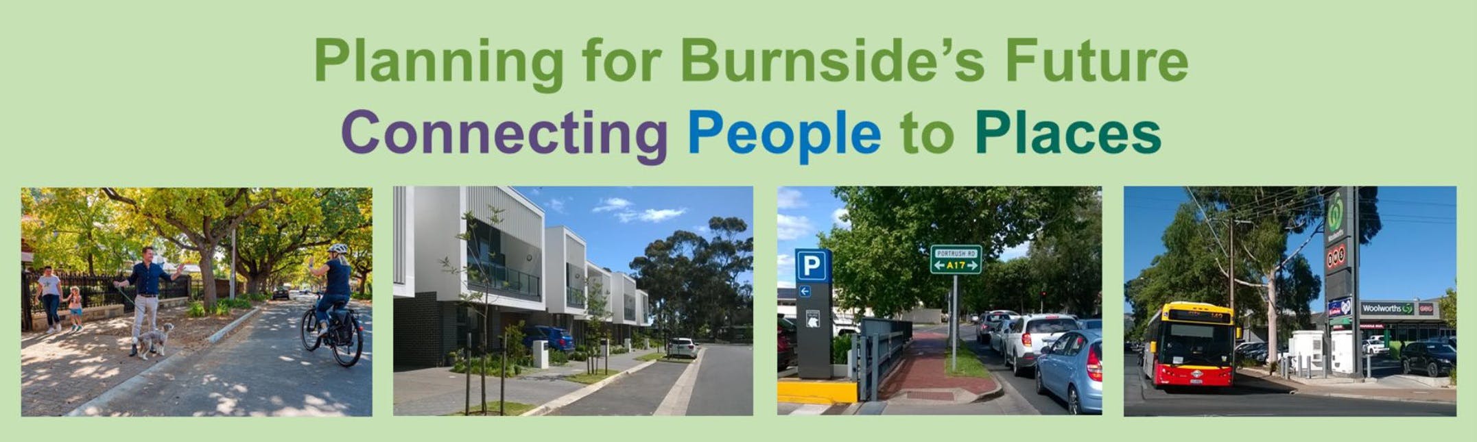
What is the Burnside City Master Plan?
The City Master Plan provides a strategic framework for the proactive and planned management of future population growth across the City of Burnside. The Master Plan proposes changes to the urban housing form and transport networks to support the anticipated population growth across Burnside over the next 10 to 20 years while increasing protection measures in Burnside’s highly valued character suburbs.
The Master Plan will not make any statutory changes to the planning or transport systems. This will be subject to future formal processes that will involve further consultation before implementation.
How will Council use this document?
Council will use the Burnside City Master Plan to:
Council is keen to hear your views and opinions on the Draft Burnside City Master Plan, prepared in response to community feedback provided during the early stages of the project in 2021.
Your feedback will help us refine the Master Plan that will shape Burnside's future look and feel. The final City Master Plan will identify future investigations, consultation and advocacy with State Government to address potential amendments to planning zones and transport infrastructure design and will inform future budget decisions.
What is the Planning and Design Code?
The Planning and Design Code outlines South Australia's planning policy and standards for proposed development. It comprises Zones, Subzones, Overlays and General Development Policies.
The Planning and Design Code became operational on 19 March 2021 and replaced all individual Council Development Plans with one state-wide system.
The Code is available at code.plan.sa.gov.au or can be viewed spatially at sappa.plan.sa.gov.au
What is a Code Amendment?
A Code Amendment is a proposal to change the Planning and Design Code and allows for areas to be rezoned. A Code Amendment can also introduce different or expanded overlays (such as the Character Area and Historic Area Overlays) or new or modified "Technical and Numeric Variations" (called local variations), which govern things like minimum site areas and frontage.
Code Amendments are overseen by the State Planning Commission, with the Minister's approval required for any proposed changes. A Code Amendment can be initiated and managed by the State Government, Council, or landowners (the latter is known as a "proponent-led Code Amendment").
The Burnside City Master Plan would require a future Council-led Code Amendment to be undertaken before any proposed changes take legal effect. All Code Amendments include a comprehensive community engagement process, where specific details regarding any proposed policy and zoning changes, including building heights will be provided.
How will the Master Plan address character and heritage?
The Burnside City Master Plan proposes a dual approach to managing the future urban form and development of the City of Burnside. The plan aims to balance an urban form that preserves the character most valued in the City of Burnside's neighbourhoods (Protection Areas) with the identification of areas that will accommodate Burnside’s growing population (Growth Areas).
One of the critical issues for the City of Burnside is the impact of subdivision and development potential on neighbourhood character as a result of the new Planning and Design Code. For example, the potential for an increased number and diverse range of dwellings allowed by the new planning system may result in more driveway crossovers, leaving less room for street trees and mature trees on private properties. To limit subdivision and preserve tree canopy, the Master Plan seeks to increase minimum lot sizes across much of the City of Burnside.
The design of new development and ensuring that historic homes are not demolished are also crucial to preserving the character of Burnside's suburbs. Accordingly, the Council is seeking to add a Historic Area Overlay to some areas within the City of Burnside where there are enough historic homes to warrant this level of protection. In other areas, the Master Plan proposes implementing a Character Area Overlay. These would provide locally specific design controls to ensure that new development is consistent and complementary to the neighbourhood's existing character.
What is the difference between a Character Area Overlay and a Historic Area Overlay?
The Character and Historic Area Overlays are planning protection layers within the State Government Planning and Design Code, which guide the form of development possible where the Overlay applies.
You can find out if your home is within an existing overlay area by typing in your address into the website link below for the Planning and Design Code:
https://code.plan.sa.gov.au/home/what_is_the_property_address?code=apply2addr
The Historic Area Overlay specifically relates to heritage protections across a broader area rather than simply protecting an individual dwelling, which is achieved through a heritage listing.
A Historic Area Overlay provides demolition protection, with demolition requiring a planning approval within this area, regardless of whether the building is heritage listed or not. The overlay also includes "Representative Buildings" (formerly known as Contributory Items), which are dwellings that display characteristics of importance in a particular area that the Overlay seeks to preserve. There are further design controls to ensure that new development is sympathetic to the heritage value of the surrounding homes.
The Character Area Overlay provides fewer protections than the Historic Area Overlay as it does not provide demolition protection. It does, however, provide increased design and contextual controls compared to the standard Established Neighbourhood Zone. The Character Area Overlay requires any new development to be subject to a more detailed planning assessment to ensure that the design is complementary with the surrounding housing.
Will this mean I cannot demolish my house?
The Burnside City Master Plan proposes future planning policy changes to discourage the demolition of homes that contribute to the desired character in an expanded list of locations.
No specific demolition protection is provided by the Established Neighbourhood Zone or Character Area Overlay. Demolition in areas where such changes are proposed would still be permitted. The Historic Area Overlay, however, limits demolition in these areas, with planning approval required before any demolition is possible.
The Historic Area Overlay already applies to parts of Eastwood, Rose Park, Dulwich, Toorak Gardens, Tusmore, Glenunga, St Georges, Beulah Park and Kensington Gardens. Council has begun investigating the potential expansion of the Historic Area Overlay to cover more of the City of Burnside's historic neighbourhoods.
The Master Plan does not implement the changes required to bring increased planning protection policy into effect. Instead, the Master Plan signals an intent to seek increased protection in some key areas via a future Code Amendment, which will be subject to further detailed investigations and community consultation with affected landowners.
What criteria were used to identify "protection" areas and "urban form diversity" growth areas?
The areas for protection and diversity were identified based on existing planning policy and responses to previous consultation undertaken with the Burnside community.
The City Master Plan analysis made additional recommendations based on subdivision patterns and the integrity of the historical development of areas which warranted further investigation for protection.
What heights are being proposed in 'diversity' areas?
There is no uniform height limit proposed across the urban form diversity areas. Each area will have a specific maximum height limit based on any potential impact to adjoining development.
To calculate the potential future housing volumes referred to in the Draft City Master Plan, heights of between 2 and 4 storeys were used as a guide. The final heights, however, would be subject to detailed analysis required as part of a future Code Amendment process and subject to community consultation before they take any legal effect.
The current Master Planning process will not lock in any decisions relating to building height.
When can we expect to see any changes?
The City of Burnside Master Plan is a 10–20-year strategy, so changes are unlikely to be immediate. Council aims to have the Master Plan agreed upon and adopted (including modifications based on feedback from this consultation) by the middle of 2022. An implementation plan and timeline will be developed as part of the final document for approval by Council.
How will this affect the value of my property?
The Master Plan will not make legally enforceable changes to the planning policy and zones within Burnside; it provides strategic direction for future changes. As a consequence, there are unlikely to be any direct impacts on property values from the Master Plan and it should not be relied upon to inform investment decisions. The implementation of any recommendations will be subject to future consultation and investigations before they come into effect.
What type of housing will be built in the housing diversity areas?
Housing diversity areas are naturally intended to provide a broad range of housing options. These may include townhouses, group dwellings (several dwellings with a shared driveway) and apartments or flats. Dwellings would typically be low-medium rise, with heights of two-four storeys, depending on the location. The range of housing delivered in the Glenside redevelopment and innovative co-housing options are examples of the different types of new housing that might be anticipated.
Will I still be able to subdivide my property?
The Master Plan is not making legally enforceable changes to the planning zones; it provides strategic direction. On its own, it will not change whether you can or cannot subdivide your property. It will, however, inform a future Code Amendment, which may make this change. This change would be subject to a comprehensive consultation process with affected landowners.
How does the Master Plan address population growth?
The Master Plan assumes that the City of Burnside will continue to have a growing population which is in line with projections from the State Government. Rather than this growth being achieved through general infill subdivisions in established residential areas, the Master Plan proposes concentrating population growth in key urban diversity areas in proximity to essential services and transport routes. This approach is intended to provide housing options that would suit first-home buyers and downsizers, in addition to the "family home" housing stock available in established residential neighbourhoods of Burnside that would have increased protections.
How will the Master Plan protect trees and maintain green canopy in my suburb?
While new State planning policy requires applicants to plant a tree as part of the dwelling development (except in some specified zones), the potential for increased driveway crossovers and increased site coverage reduces the space available for the planting of trees both on site and on street. The Master Plan seeks to reduce the number of new crossovers by limiting subdivisions, and reducing building site coverage in some areas, thereby preserving street trees and increasing the space available for tree planting.
How will the Master Plan address challenges to the environment?
Our community values highly our city’s natural environment and this has driven the integration of environmental protection within the various elements of the draft City Master Plan. The City Master Plan sets out approaches to environmental protection that can be achieved through urban and transport planning. It is complimentary to Council’s already extensive suite of environmental strategies, plans and policies.
These are explained throughout the detailed City Master Plan document, being:
• The guiding principles on page 6 clearly set out the Master Plan’s role in protecting our local environment within the scope of urban form and transport.
• Page 16 under the heading “environmental policies” also brings together the interrelationship between our urban form, transport system, and our urban tree canopy.
• Pages 12 and 13 demonstrate the interrelationship of our urban form and tree canopy and clearly explains that new approaches to managing our city’s growth are needed to protect our natural environment.
• Page 12 also details the need to increase minimum lot sizes in a large proportion of our city to reduce the number of housing demolitions, subdivisions, and new crossovers, thereby minimising the loss of tree coverage.
• Page 14 and 15 explains the “growth areas” approach and how this can minimise driveway crossing points and allow opportunities for more street tree planting. This section also sets out the need for planning policy in these “growth areas” that emphasise canopy cover and plantings on street frontages.
The Master Plan also explains how the proposed “growth precincts” will encourage density in areas nearer to transport services, shopping, etc., to help residents reduce their personal environmental footprint.
How will the Master Plan address the traffic and parking in my street?
Much like street trees, more driveway crossovers due to subdivision reduce the space available for both off-street and on-street parking. The Master Plan seeks to preserve the existing space available for on-street parking by limiting sub-division.
Will 40km/h speed limit areas result in slow moving traffic and add more time to my trips?
Research shows that a 40 km/h speed limit area does not significantly affect journey times as travel on local streets is generally only for short distances to arterial or sub-arterial roads. The purpose of the 40 km/h speed limit is to improve safety and amenity for local residents and the walking and cycling environment.
Public Transport Terminology
The public transport terminology used in the Draft City Master Plan is explained as follows.
Go Zone is a bus corridor with one or more bus routes with a combined service frequency of:
On-demand transport is a flexible bus service designed to improve connections to transport hubs and popular destinations like shopping centres and community centres. For example, on-demand transport service in Gawler and Mount Barker is currently operating for local trips instead of regular fixed-route timetabled bus routes.
Traffic Management Terminology
Bicycle Infrastructure Terminology